Snow Observations List
We rode Buck Ridge through First Yellowmule, Buck Creek, Second Yellowmule and into McAtee Basin. Pulses of snow through the day dropped an inch or two by the time we left. Light winds, no avalanches, and no signs of instability to report. The measured storm total above the melt-freeze crust was 11" (1.3" of SWE) at the top of 1st Yellowmule. The snow was well bonded to the underlying surface. Quick pits testing the snow above the melt-freeze crust yielded no indicators of instability.
The riding was quite nice other than the lowest section of the Doe Creek Road is melted out. It was fine on the way in, but very muddy on the way out.
Triggering an avalanche is unlikely UNLESS:
- The wind picks up to speeds capable of transporting snow.
- The temperatures increase or slopes get hit by the warm spring sun.
- There is another significant pulse of snowfall.
The danger at Buck was LOW today. I would drop the Northern Madison unless Big Sky Ski Patrol reports active wind-loading or the winds pick up, in which case I would do a MODERATE/ LOW split.
The other caveat is rising temperatures. Reevaluate the LOW recommendation if it seems like Wet Snow problems will come into play tomorrow.

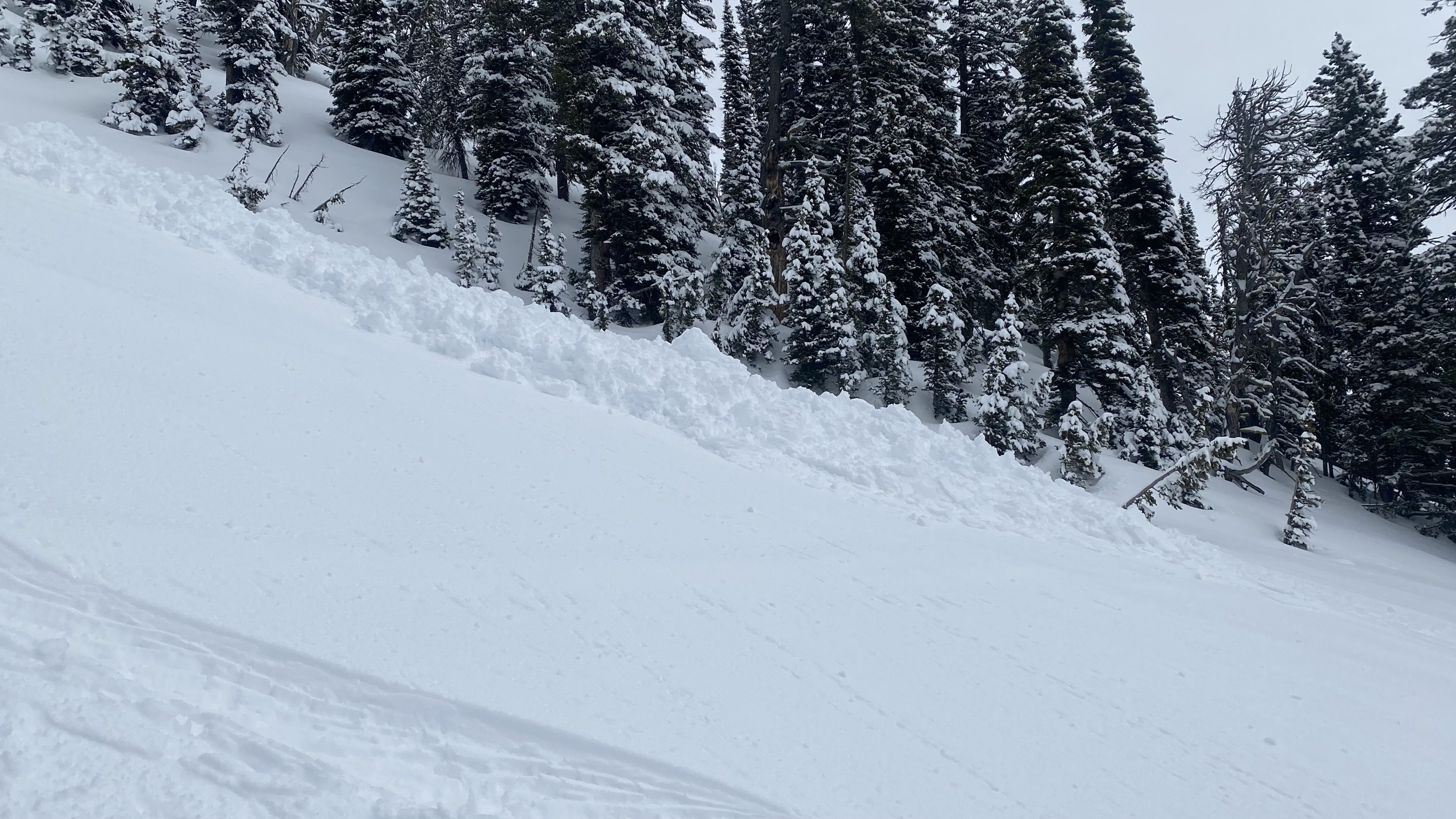
From email: "Ski touring near Cooke City today we intentionally triggered a storm slab/ wind slab on a steep north aspect around 9600'. It was about 6" deep, and 30' wide."
Full Snow Observation Report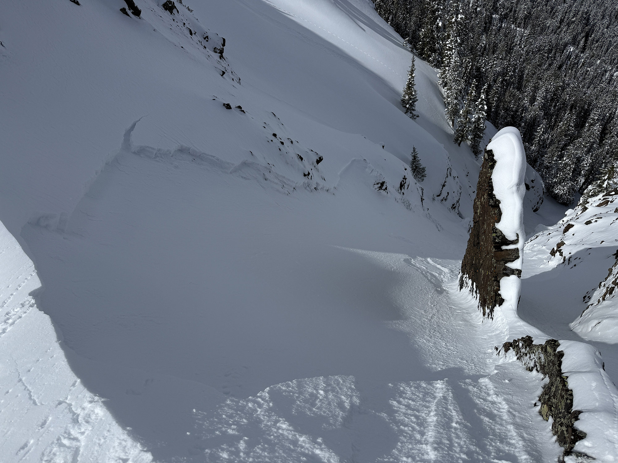
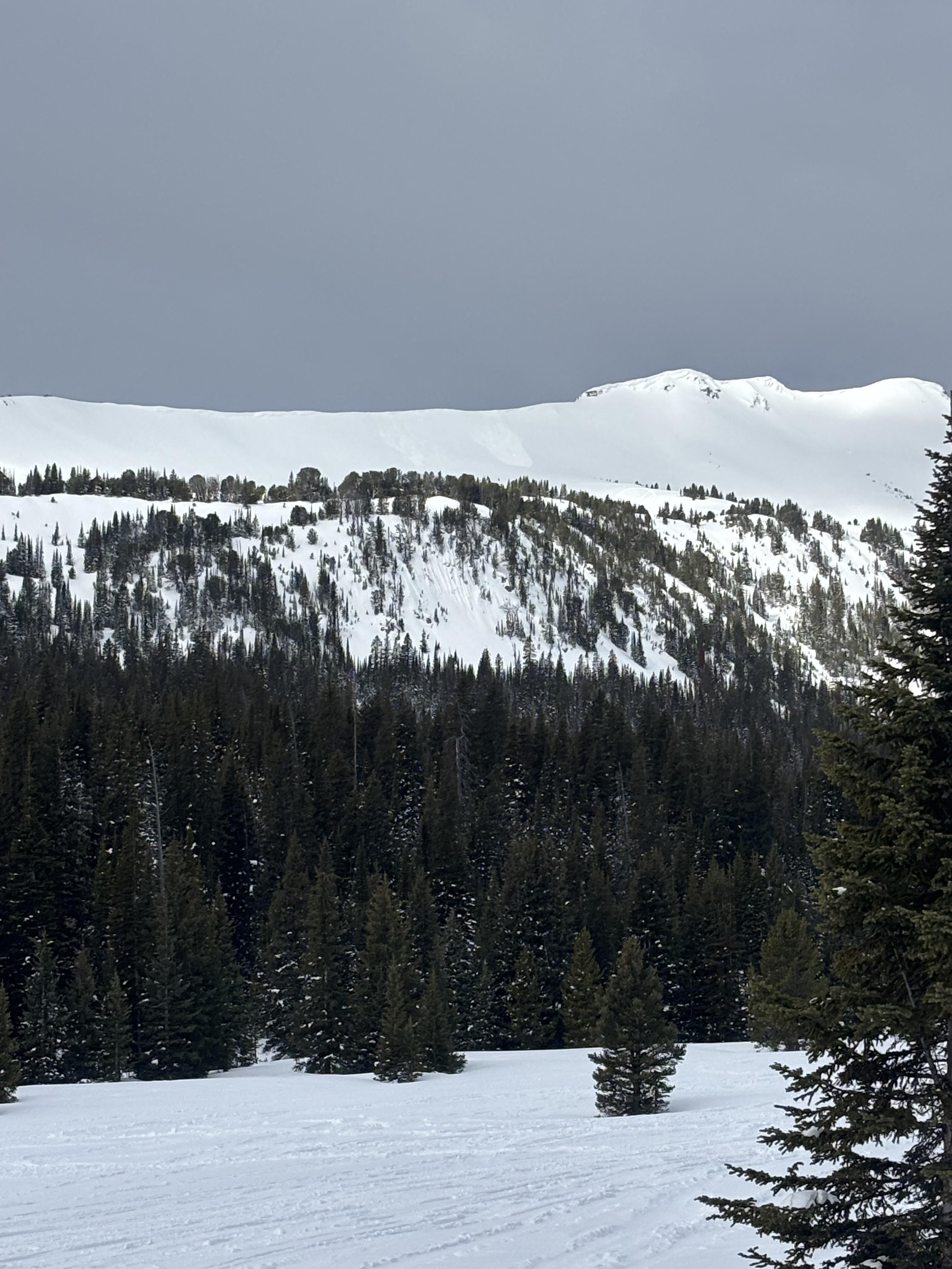
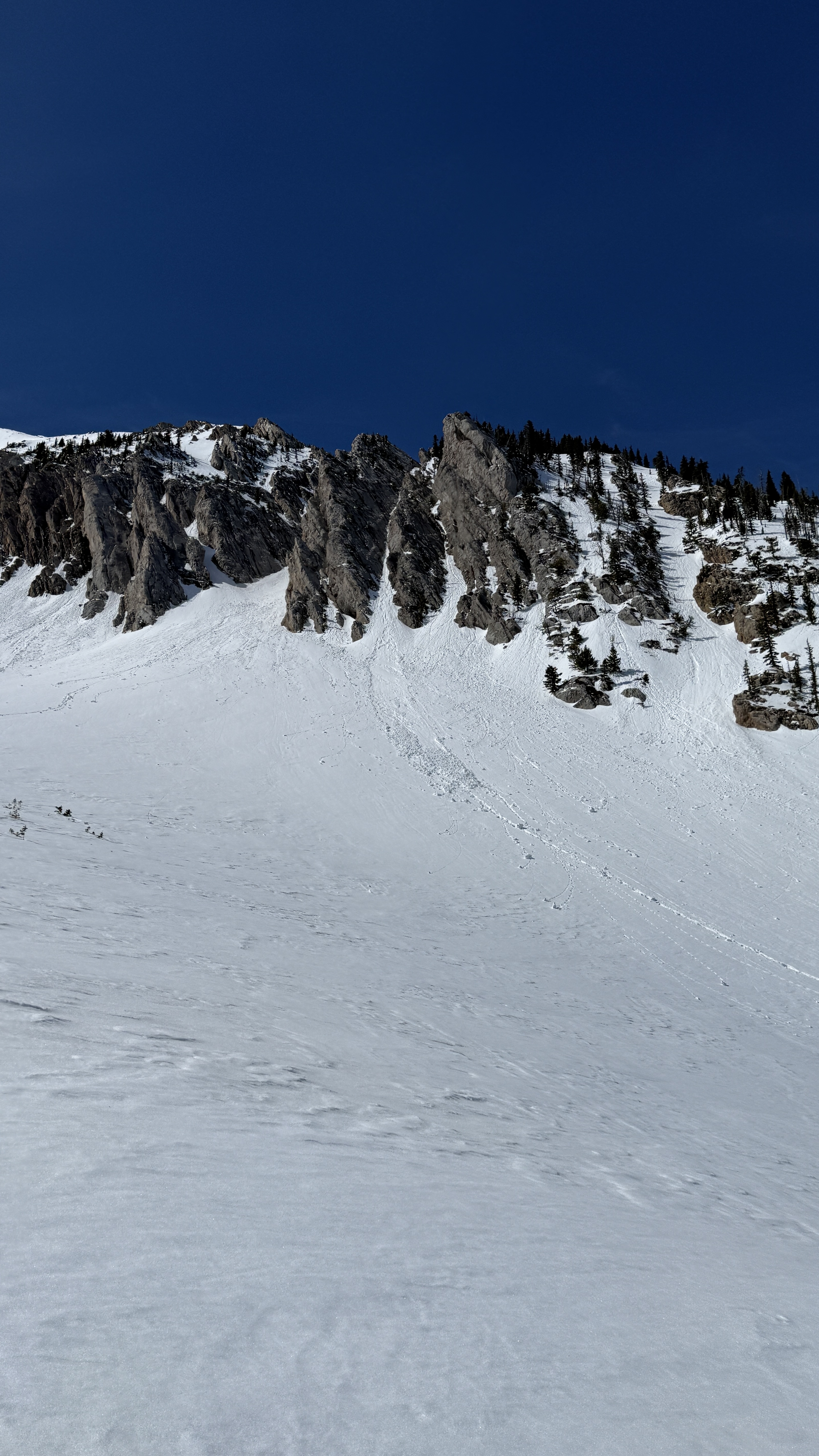
We skinned up to the Beehive-Bear ridgeline, down into Middle Basin, up Middle Peak and returned the way we came.
It snowed on and off all day, with little accumulation and patches of sunshine mixed in. Winds were moderate at ridgelines and light-calm lower down. During the periods of sunshine we had good views into Beehive and middle basin. We saw no recent avalanches or signs of instability.
There were 10-12" of new snow from the last couple days above firm crusts. The new snow had bonded well to the crust. We encountered a little wind drifting at the ridgeline, but it hadn't formed much of a windslab. Loose dry sluffs were the biggest hazard we encountered. The little bit of sunshine densified the snow surface and caused roller balls, but wasn't enough to increase the hazard.
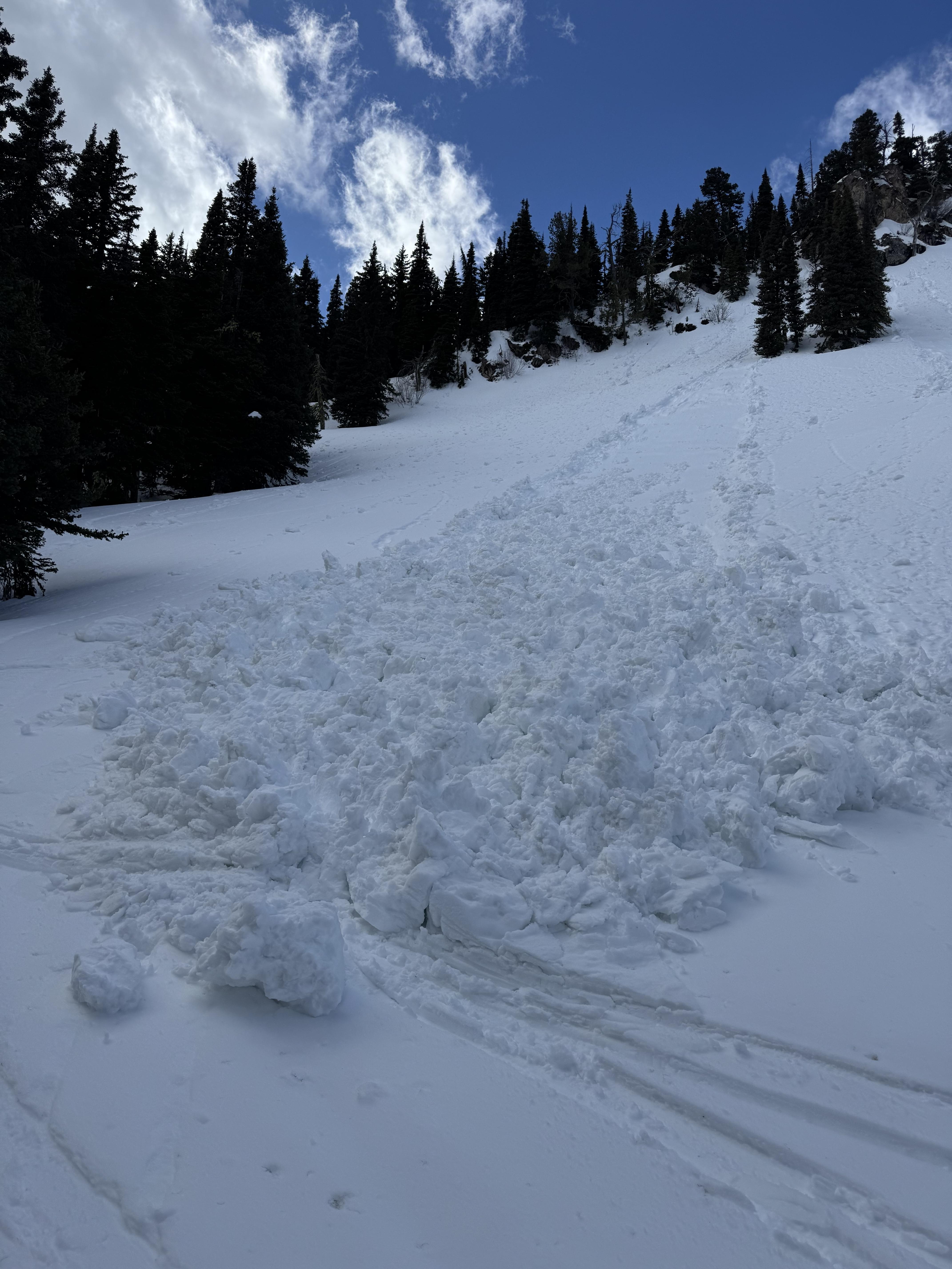
Full Snow Observation ReportWe headed out to the Bridgers this morning with 13" (1.4" SWE) and more on the way. It may have been April Fool's Day but this was no joke - it is deep out there! We rode out to the Throne and made our way up the East Ridge. On top of the foot of fresh, it snowed around 3-5" in the three hours we were out there.
Our main concerns today were dry loose, storm slab, and wind slab avalanches. We were able to trigger small, loose snow avalanches on steeper slopes in the upper 6" of snow. In one steeper roll over, I got shooting cracks and a small storm slab to break at my ski tips. We did not see other cracking in the recent snow. Visibility was very limited, but we saw one small, filled-in crown near steep, rocky terrain just above the top of the Throne. Winds were blowing all day but were not noticeably drifting snow at mid-elevations.
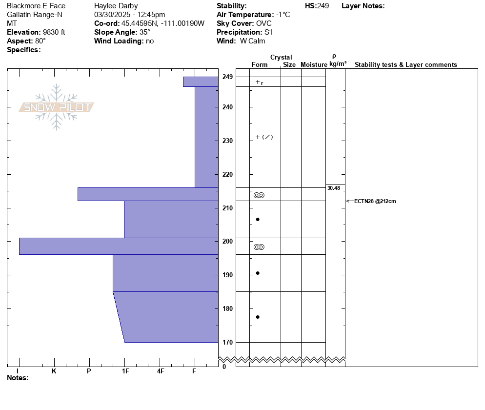
When we dug down and performed quick stability tests, we got a mix of ECTNs and propagation (ECTP 10, 11) on a hardness change within the storm snow about 12" deep. We noted this hardness change throughout the day. At lower elevations it was only 3-4" deep, while at upper elevations, closer to a foot.
Lower down on the E Face, we saw a glide crack that had opened likely after the warm temperatures from last week.
Full Snow Observation Report

Heavy, wet slide of recent snow released while skiing off South Saddle. Photo is from South Central.
Full Snow Observation Report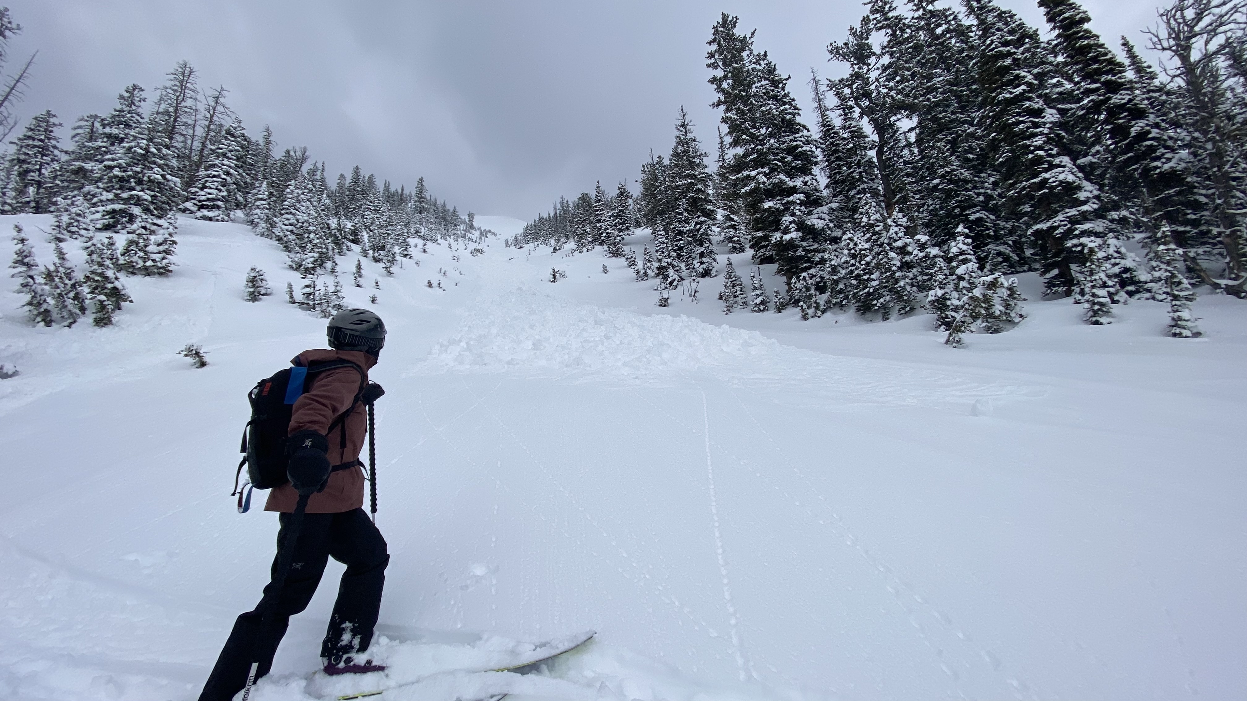
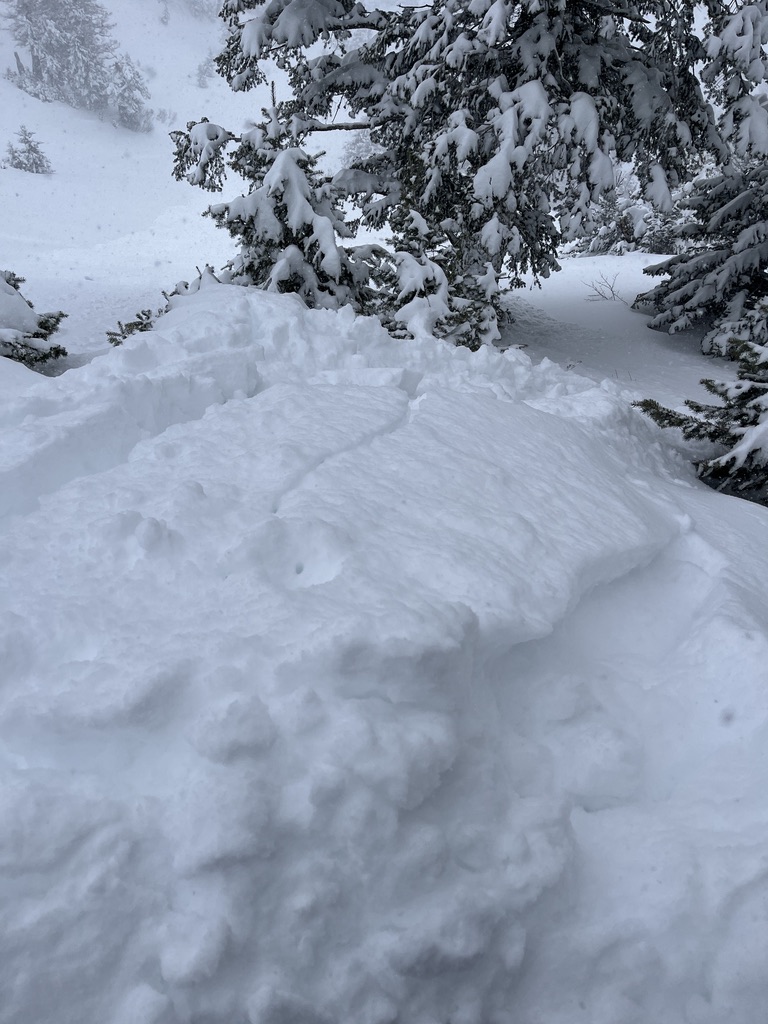
Winter conditions in middle basin. Cracking in wind drifted pockets at the top of bat ears couloir and at the top of middle peak. Snowing hard all afternoon nearly filling in our skin track by the time we exited.
Full Snow Observation Report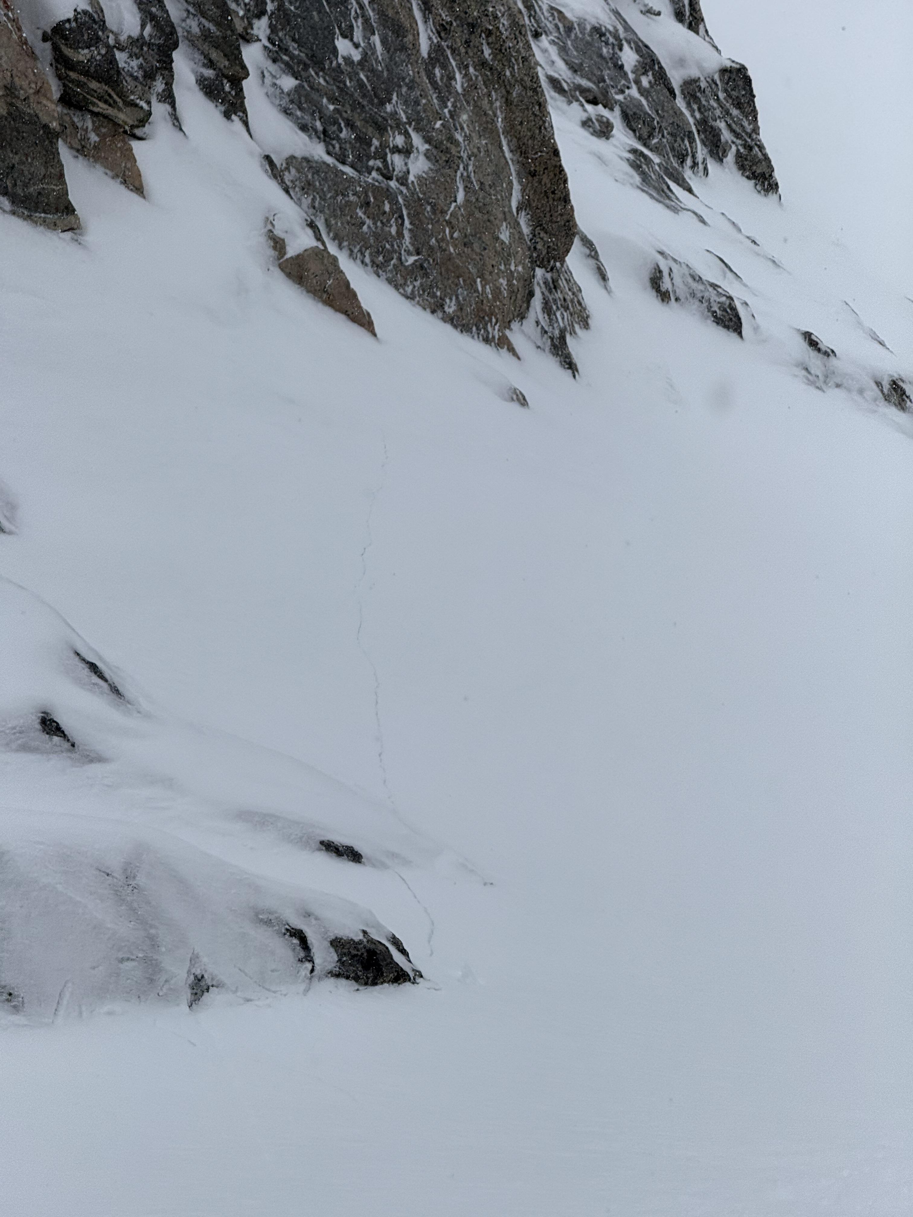
Skied Hellroaring Hut in the Centennials from Friday Mar 28 through Mon Mar 31.
Skied and observed all aspects between 7700' and 10,200' in the vicinity of Mt Jefferson and Reas Peak.
We had good visibility for three days and saw no signs of slab avalanches; no whumphing or cracking; and no signs of blowing or drifting snow (prior to new snow arriving today (Mar 31) snow surface was locked up with solid melt-freeze crusts on all aspects and elevations).
Snow surface starting to show meltwater runnels on S through E aspects below 9000'.
Test pits on N and S aspects at 9100' revealed moist snow under melt-freeze crusts (3" thick breakable crust on N aspects; 10" thick stout crust on S aspects) and no identifiable layers of concern in the upper 130 cm of the snowpack. HS 165 cm on S aspect at 9100' and HS 260 cm on N aspect at 9100'.
We observed pinwheels and predictable wet loose avalanches (D1 to D1.5) on solar aspects above 8000' on Fri and Sat.
Snow started this morning (3/31) and 2.5" of new snow had accumulated when we left at 11:00 a.m. Moderate to strong winds blowing from the south today.
Full Snow Observation Report
Shooting cracks in wind drifted snow on the northwest side of Miller Ridge, and wet loose slides on the southeast side. Very variable out there.
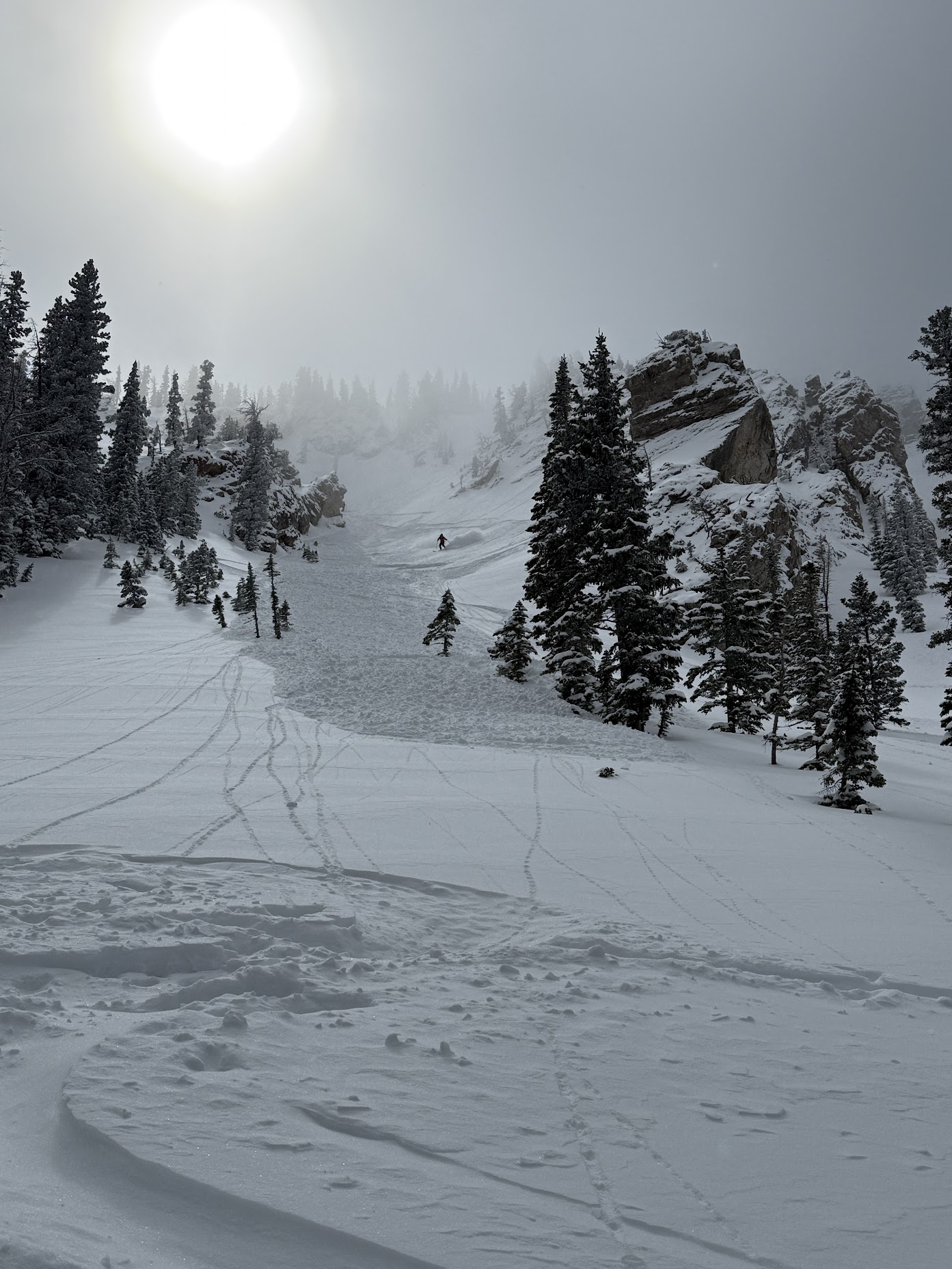
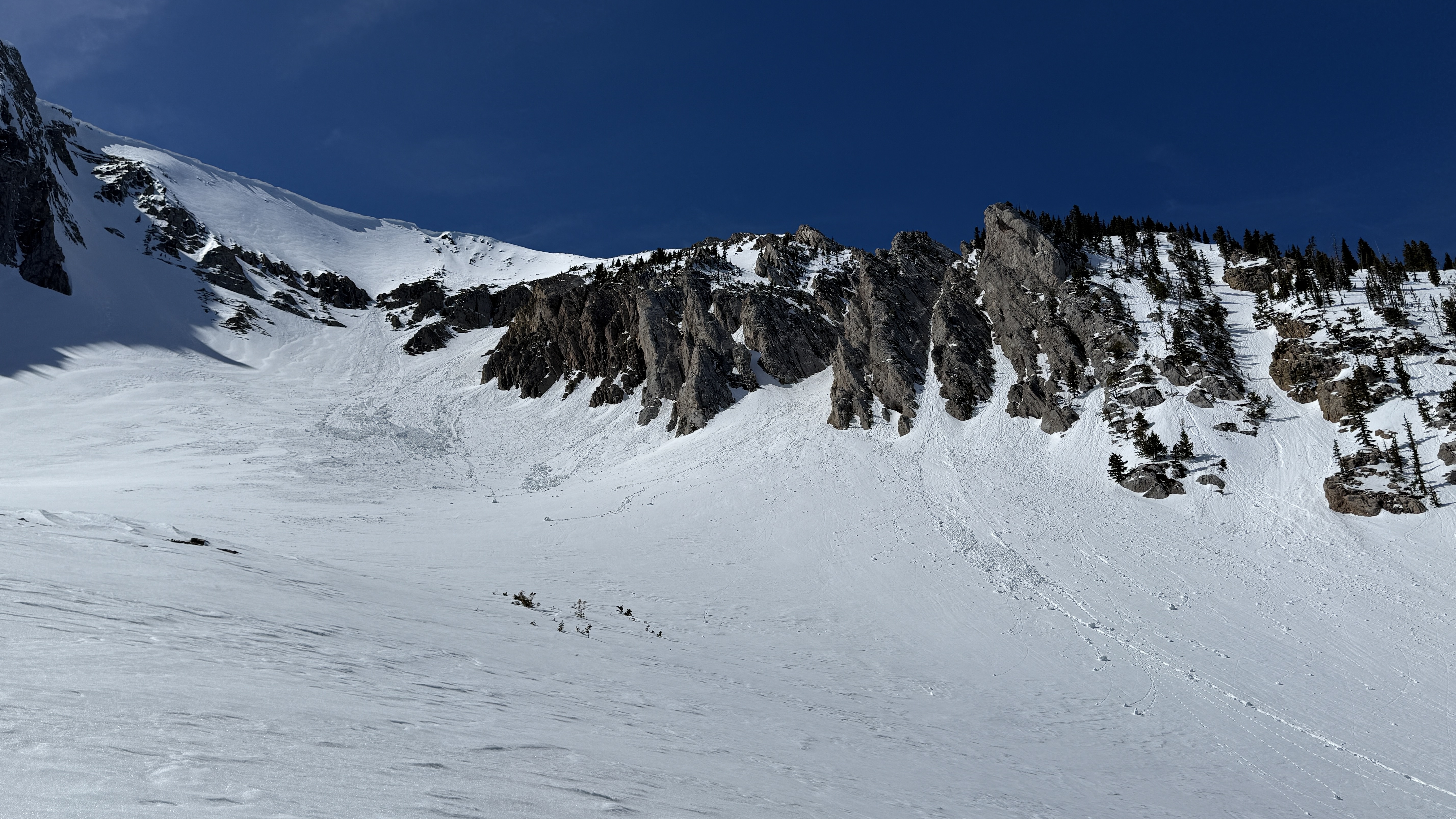
Full Snow Observation ReportThe skiing was good and non reactive on the main East face next to the skin track. The North gullies into Naya Nuki creek and the the lower/steeper gullies to the south were highly reactive and entraining lots of snow.
Full Snow Observation ReportSkied the north chutes above fairy lake around 8,400 ft. Found 8-12" of new snow, with the bottom 2" consisting of large graupel. In steep terrain our sluff entrained lots of snow making for some large debris piles. Overall the snow was generally well bonded.
Full Snow Observation Report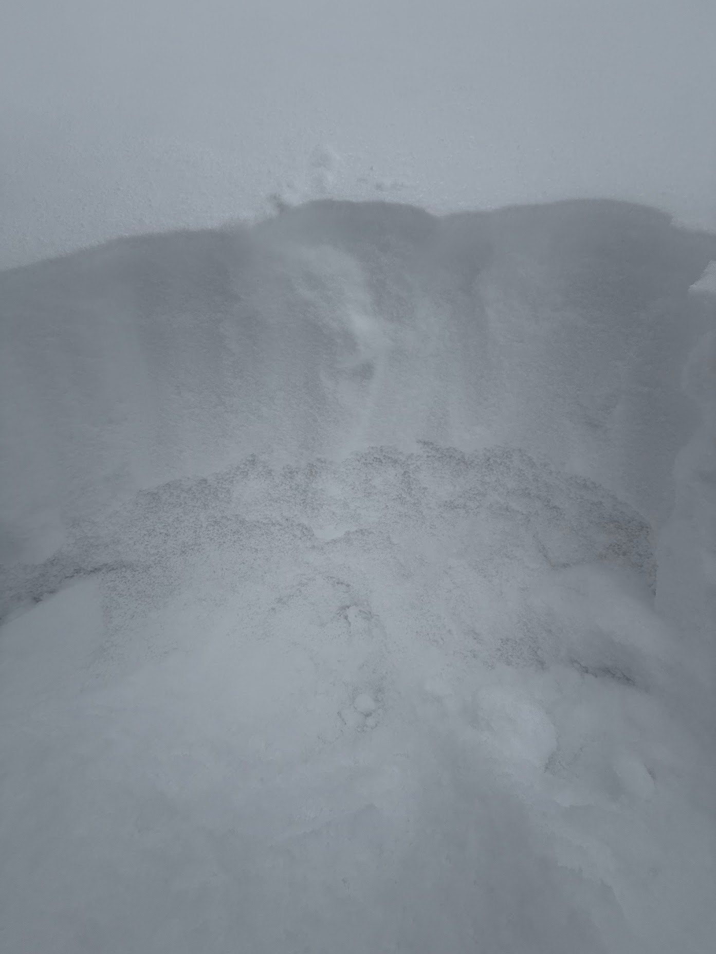
We toured up to Mt Blackmore today and found that winter had returned to the high peaks over the last two days. Since yesterday morning, high elevations around Hyalite have received about 12" of new snow (1.2" SWE). The parking lot had around 3", the trail around 6" and at elevations above 8500' the numbers corresponded well to the Shower Falls SNOTEL.
The parking lot and lower trail softened up throughout the day and temperatures were above 32 degrees at the car at 3pm. In the alpine around 9800', temperatures were just below freezing (31 degrees) around 1pm. Despite our layers and gear getting a bit soggy, the snow from last night remained dry.
A mix of rimed precipitation particles and graupel fell throughout the day. Previous and current winds were calm; there was little to no wind effect on the new snow. we saw no cracking or recent drifts. The 12" of snow since yesterday fell right-side-up and had little to no slab properties. This new snow rests on a stout melt-freeze crust from the high temperatures last week.
Our main avalanche hazard today were dry-loose avalanches. Despite lots of traffic in this zone today, we only saw a handful of slides in steep terrain, and all were relatively small and did not entrain much snow. Conditions can and will change quickly if winds increase or the sun comes out and warms the new snow, but for now, we were happy to find good powder skiing.
Full Snow Observation Report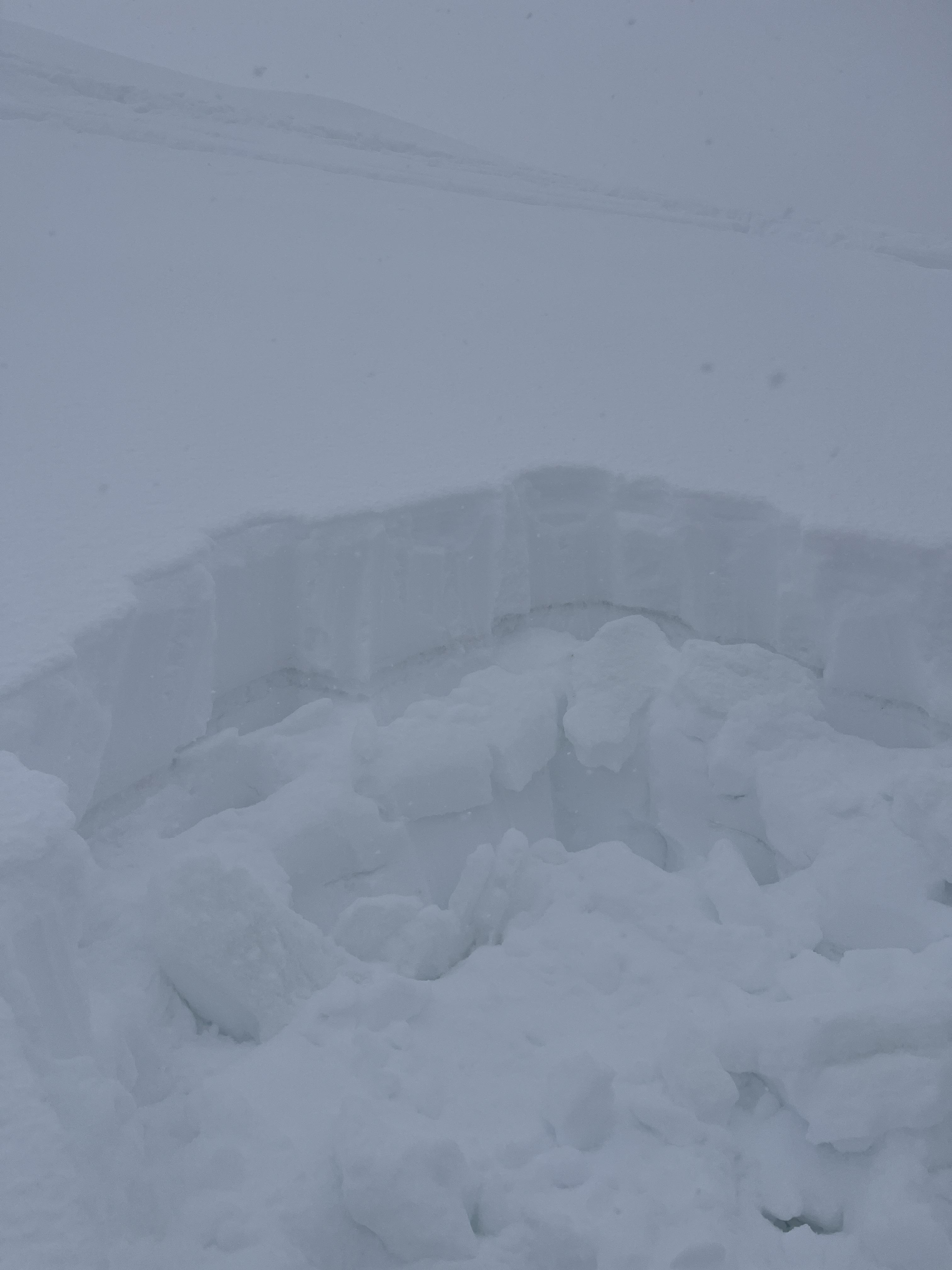

Skied the Banana today with 8-12” of new snow that has mostly bonded. The snowpack below the new snow had froze over night and was well consolidated.
Observed a layer of graupel (3-4mm grains) at the new/old interface on the NE ramp starting at 8600’ and clearing up after 8700’. This layer created some reactivity in the storm snow.
Wind slabs <6” had formed on N and NE aspects. We had one small release in the bottom of the couloir measuring ~10x20’ and running ~50’.
Other than that, the skiing was amazing and manageable.
Full Snow Observation ReportToured around Beehive and Middle Basins this morning, finding predictably bulletproof snow on most aspects but decent turns aided by the 2-4 inches of snow from last night on northerly terrain that hadn’t been destroyed by the sun this week. There were a few brief moments of direct sun throughout the morning, which almost instantaneously triggered point releases from steeper rocky terrain. On the way back through Beehive we observed some much larger debris piles that weren’t there this morning from the steel rocky face between the Going Home chute and the prayer flags.
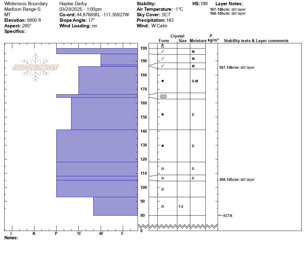
Full Snow Observation ReportWe rode into the Taylor Fork, up to the weather station, and out towards the wilderness boundary. Temperatures were around 40 degrees at the car. There was a surficial refreeze last night with a skiff of graupel on top. With mostly sunny skies and calm winds the snow surface dampened quickly.
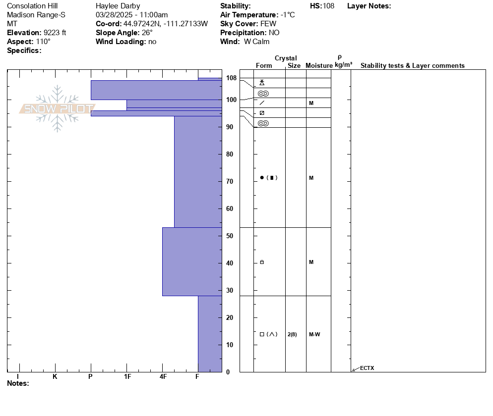
We dug down on two sunny aspects (E-SE) and noted moist snow throughout the snowpack. In our first snowpit (9220', HS:108) we did not get notable test results (ECTX). We found that although faceted snow remains at the base of the snowpack, water has percolated down and moistened these basal layers.
We also dug on a NW aspect (8800', HS:199) with no notable test results (ECTX). Moist snow exists in the upper 1.5' of the snowpack with dry snow to the ground.
We noted no cracking or collapsing. We saw a good number of wet-loose avalanches on steep sunny slopes, but all were relatively small in width and depth.
Full Snow Observation Report

We skied Saddle as early as we could after the lifts opened, but we were still a bit late, and/or there was limited overnight refreeze, I suspect more of the latter. Clear-ish skies overnight had me optimistic, but warms temps seem to have dominated below 9000 ft.
The first 100 vertical feet from the summit skied quite well where a thin melt-freeze crust was just starting to break down. Overcast skies and L-M winds likely limited warming. Below 9000 ft we poked around and found the top 15-20cm was moist and unsupportive on NE-SE aspects. We kicked off numerous roller balls but no actual loose wet avalanches.
The best skiing was in previously skied areas, such as the guts of going home chute, or in-bounds.
Full Snow Observation Report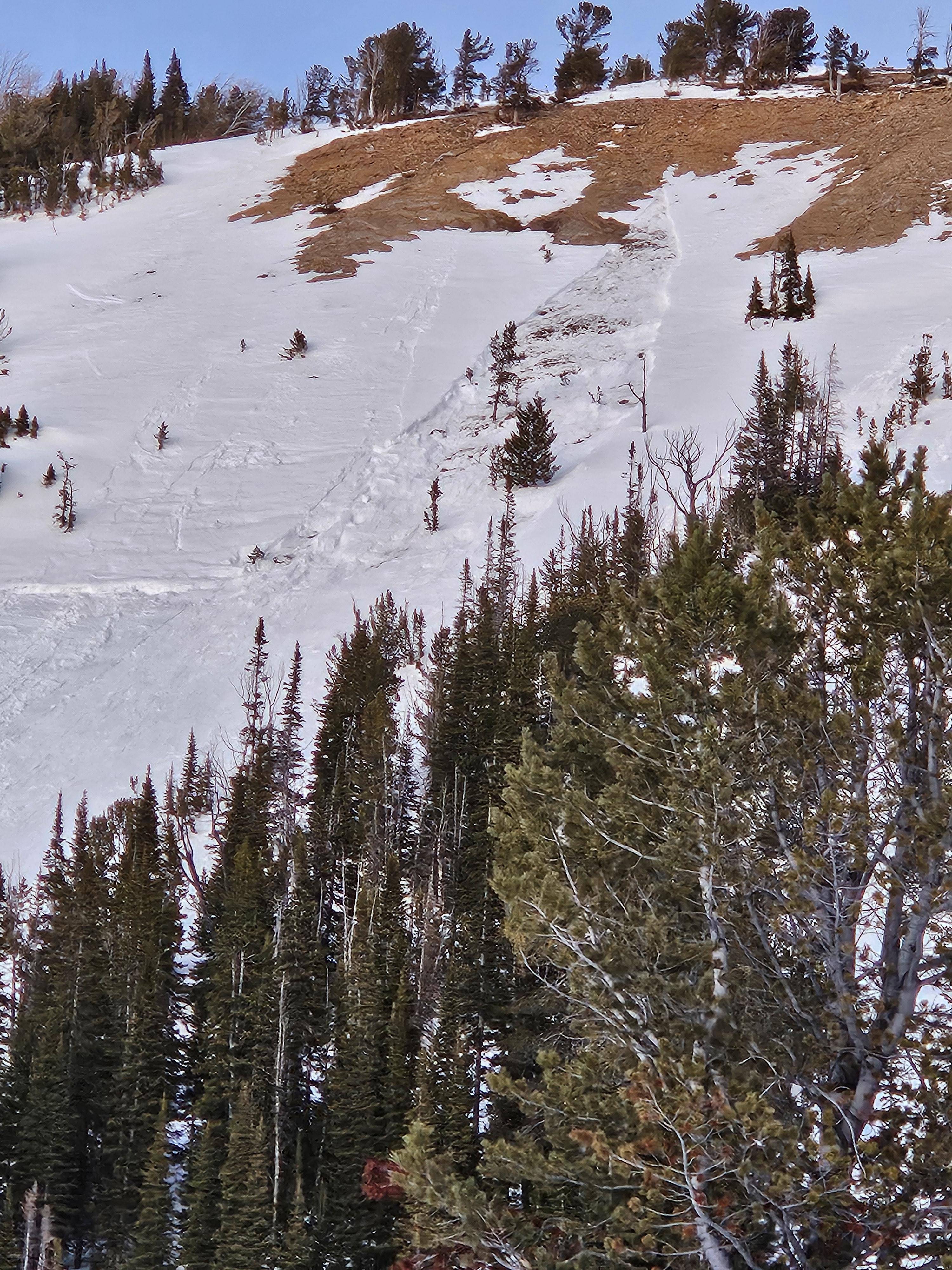
We rode up to Fairy Lake area today and quickly found out just how warm it has been in this area the last two days. At the trailhead at 10am temperatures were around 47 degrees. Last night, it did not freeze below 9000' and an isothermal snowpack now exists from the trailhead all the way to Fairy Lake and above, until you pop out into Airplane Bowl. When we returned to the trailhead around 2:30pm, it was 65 degrees at the truck.
While higher elevation southerly and easterly snowpacks were warm and wet, free water was only moving through the upper few inches of the snowpack by 1pm. High elevation northerly aspects remained colder and more locked up than we expected given the ambient air temperature. Winds were light from the W and were doing little to keep surfaces cold.
There were a number of wet loose avalanches in Airplane Bowl when we were heading out around 2pm. All on E/S aspects near rocks or cliffs. Most were relatively small and had not entrained much snow from the surface or gouged deeper than a few inches.
On the drive back to town, we noted 5 or so larger wet loose avalanches in Argentina Bowl, with a good number of smaller slides at different points along the ridge
Seeing as it is now the season for wet snow hazards, there are a few things that are critical to consider: aspect, elevation, and timing.
Timing your day to be off of steep slopes before melt water percolates too deep and destabilizes the slope is key, AND making sure to account for steep low-elevation slopes that you may have to pass through on your way back to the trailhead. If you start to sink in deeper than your ankles, or your sled track is digging into slush, that means it is time to either shift to colder aspects or head back to the trailhead.
Our greatest concern with these wet loose avalanches is not so much their size, but their power to push you into terrain traps like cliffs, gullies, trees, or rocks. The two scenarios when we are most concerned about these avalanches are when new snow gets wet and sheds for the first time OR when there have been multiple days without a solid refreeze and melt-water percolates deep into the snowpack.
Full Snow Observation Report

We skied past a wet loose avalanche that came off of the south face of Bradley‘s Meadow. It was slightly bigger than the rest of the wet snow activity that I observed during the day.
Full Snow Observation Report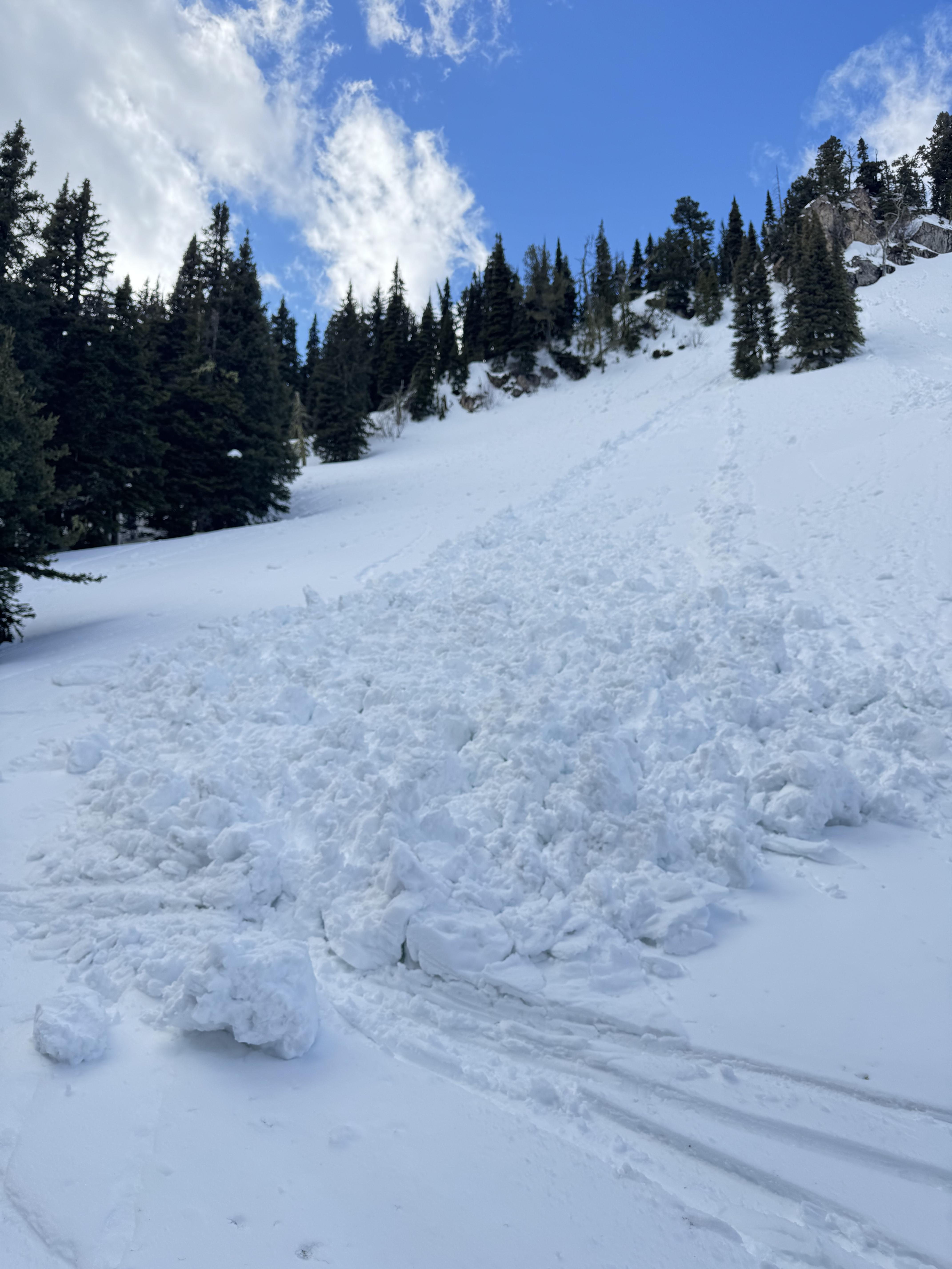
We rode around the far end of Buck Ridge today (Bear Creek, McAtee, 2nd Yellow Mule) and found very warm temperatures and increasingly spring-like snow. Almost everywhere at upper elevations there was a thin melt-freeze glaze on the snow (except in deeper shade and lee areas where the weekends wind pushed snow). Below the surface 4-6" the snow was still fairly dry too. We could see a few point releases from yesterday's warmth in steeper and rockier areas but otherwise no avalanche activity up high. The riding ended up being surprisingly good still and the bottom 3 miles of Doe Creek Rd are snow/slush/ice covered for now. That will not last much longer.
On the drive home in Gallatin Canyon, however, we did see some wet slides in the chutes/gullies south of Lava Lake (photo attached).
Full Snow Observation Report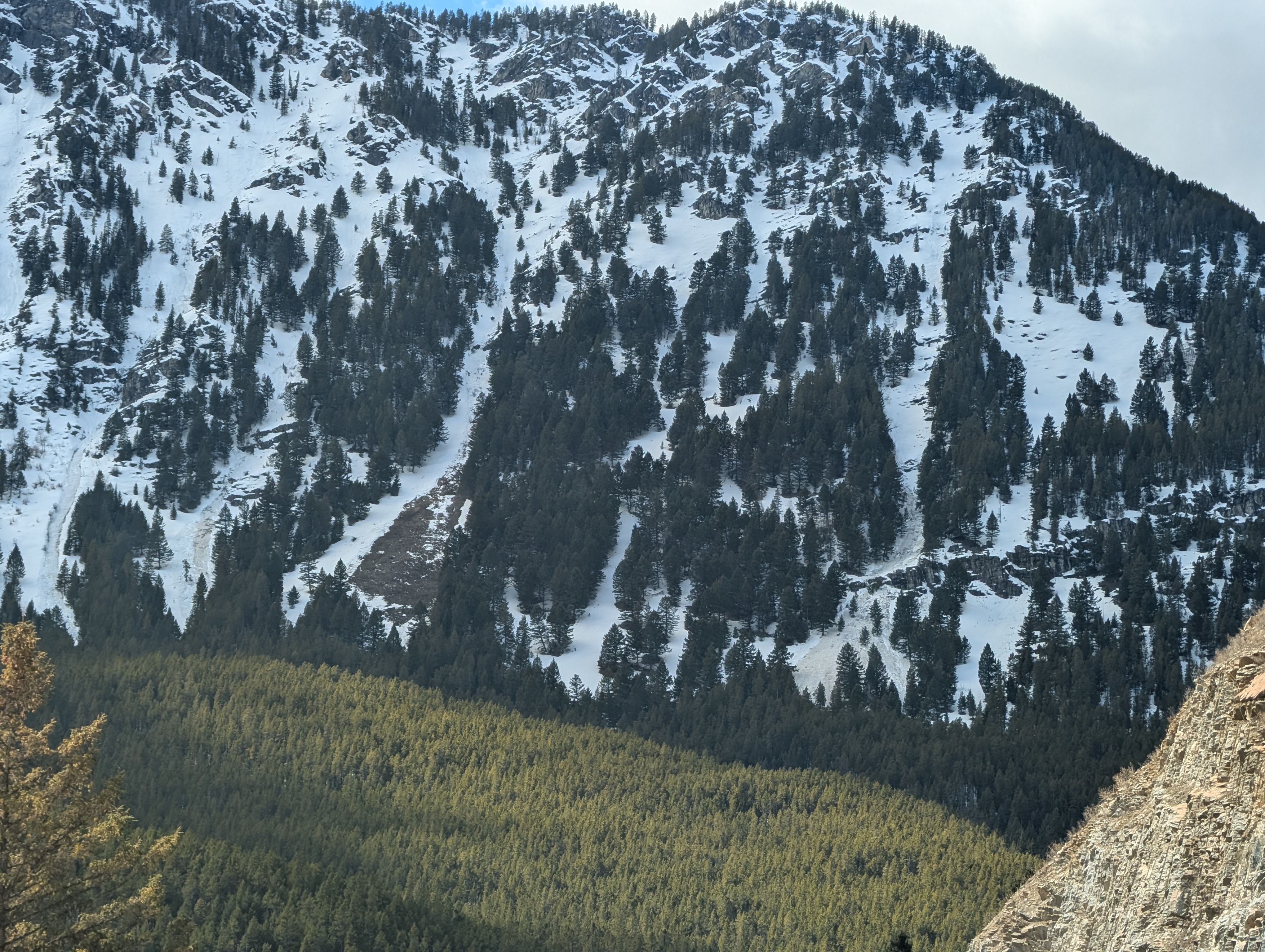
Today we noticed these natural small wind slabs on Mt Henderson.
We also observed active wet loose in Zimmer Creek today on rocky terrain.
Full Snow Observation Report